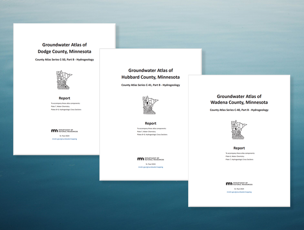
In recent months, the Groundwater Atlas program at the Minnesota Department of Natural Resources (DNR) published new atlases for Dodge, Hubbard, and Wadena counties. Each atlas includes a comprehensive report covering the county’s hydrogeology and groundwater flow, water chemistry, pollution sensitivity, aquifer characteristics, groundwater use, and more. Oversized plates focused on water chemistry and conditions along hydrogeologic cross sections provide even greater detail. These products are available as PDF files on the DNR website (mndnr.gov/groundwatermapping). Geographic information system (GIS) files, including associated metadata and ArcMap files, are also offered for download and use.
The content may help people identify viable water sources, evaluate supply, understand recharge sources and flow, manage groundwater sustainability, inform well and septic system construction decisions, guide wellhead protection for public water supply, and assess pollution sensitivity.
To support the release of the new atlases, the group shared its findings and instructional exercises with area organizations and residents at local workshops throughout the fall and winter. These events were held in partnership with the individual counties and the Minnesota Geological Survey, which produces the “Part A” geology atlases that provide foundational information for the DNR’s “Part B” groundwater atlases.
Atlas highlights
- Dodge County: Located in southeastern Minnesota, most of the county has flat to gently rolling terrain that is in cultivation. Western portions of the county are dominated by thick layers of unconsolidated glacial sediment; sand and gravel within these deposits are rarely used for water supply. Eastern portions of the county, especially northeastern and east-central, are dominated by karst. Karst provides rapid water movement between the land surface and underlying aquifers, increasing pollution sensitivity. Beneath the entire county is a thick sequence of Paleozoic sedimentary bedrock layers. A regionally significant aquitard, the Decorah–Platteville–Glenwood, subdivides these layers into two aquifer systems: an upper carbonate aquifer and the deeper combined St. Peter–Shakopee aquifer. Throughout most of the county, thick layers of glacial deposits and bedrock aquitards keep pollution sensitivity low. Younger water (recharged since 1953) and anthropogenic chloride and nitrate are largely limited to portions of the upper carbonate aquifer system within or near karst where depth to bedrock is less than 50 feet. Naturally occurring chemicals, such as arsenic and manganese, are common. Arsenic was detected in over half the samples, but none exceeded the drinking water standard. Manganese was present in 95% of the samples; nearly 11% of those samples exceeded the health-based drinking water value.
- Hubbard County: Located in north-central Minnesota, the county lies entirely within the uppermost reaches of the greater Mississippi River watershed. There are two main buried sand and gravel aquifer systems: the upper and lower. The upper, which provides water to 93% of wells, usually follows a surface-water flow system from higher to lower elevations occupied by streams, lakes, and wetlands. Evidence of a connection between surface water and groundwater appeared in wells downgradient of some lakes. Groundwater recharged since the 1950s was found in aquifers up to 150 feet deep, indicating higher sensitivity to surface activities. Pollution sensitivity is highest in the outwash plain sand and gravel deposits in the south and channel outwash deposits in the north. In the southern half of Hubbard County, where crop cultivation is common, chloride and nitrate concentrations from human sources were primarily found in wells less than 100 feet deep. Elevated chloride also occurred near highways, potentially from road salt. Naturally occurring arsenic and manganese appeared in a significant number of samples. While over half of the samples contained arsenic, only three exceeded health-based guidelines; over half of the samples exceeded health-based guidelines for manganese.
- Wadena County: Located in north-central Minnesota, the county lies entirely within the greater Mississippi River watershed. Surficial and buried sand and gravel aquifers are abundant and often productive at shallow depths. Groundwater flow direction is typically consistent with surface-water flow, moving from topographic highs toward lows occupied by streams, lakes, and wetlands. Evidence of a connection between surface water and groundwater appeared in wells downgradient of some lakes in the north. Groundwater recharged since the 1950s was found in aquifers up to 150 feet deep in the north, where thick surficial sands are in connection with buried sand aquifers, decreasing to 60 feet below the land surface in the south, where buried aquifers are less connected to the surface. Aquifers closest to the land surface had higher pollution sensitivity, as did deeper aquifers overlain by sand and gravel. Shallow wells near cultivated or developed land and roadways tended to be most impacted by anthropogenic chemicals. Like in Hubbard County, naturally occurring arsenic and manganese appeared in a significant number of samples. While over three-quarters of the samples contained arsenic, only two exceeded health-based guidelines; over half of the samples exceeded health-based guidelines for manganese.
What’s next
Currently, the Groundwater Atlas team is working on several additional atlases and will publish Isanti and Houston counties in the coming months. Sampling in Dakota County will begin this spring, with Lincoln and Pipestone planned for later in the field season.
Partial funding for the groundwater atlas project is provided by the Minnesota Environment and Natural Resources Trust Fund and the Clean Water Fund.
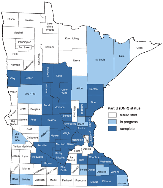
The Part B status map as of March 1, 2025. Staff update the map when new atlases are published or when sampling starts.
MGWA is committed to developing a just, equitable, and inclusive groundwater community. Click on the button below to read MGWA’s full diversity statement.